D131: MULLION to PENZANCE
Thursday 2nd May 2024
Today miles: 23.2 Total miles: 2156.6
Thanks to the three hour night time helicopter training exercise going on at the nearby Predannack airfield, less then a mile away, I had a very poor sleep last night. That might explain why nobody else was camping here last night. Anyway, on the plus side, as I left the Tenerrife campsite the sky was a clear blue and there’s not a single cloud in the sky.
I knew that I had a long day ahead of me but I was still hoping to arrive at Penzance youth hostel, a mere 23 miles away, before it got too dark.
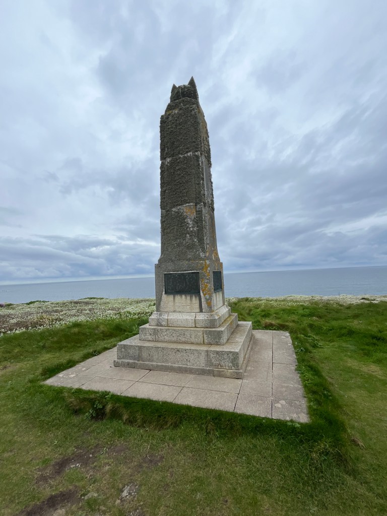
There’s several large grand hotels along this part of the coast but on quick inspection I was disappointed to find that each one was closed to guests for breakfast. I was pleasantly surprised when I came across the Marconi Monument, erected to commemorate the endeavours of Guglielmo Marconi and his associates. Marconi was a scientific pioneer in the early half of the 20th century around wireless telegraphy and was responsible for the first wirelesss signal transmitted across the Atlantic. I noticed that the monument also needs a good clean as it’s covered in moss. Shortly after passing the Marconi centre I met up with a local man out walking his dog and we walked together for a while until we reached Church Cove. Half an hour later I reached Gunwalloe and sat down on the grass for a drink and a chocolate bar. There’s a long two mile strip of beach which stretches all the way to Porthleven. I wasn’t sure that if I climbed down onto the beach I’d be able to get back off after two miles, so as enticing as it looked I just decided to stick to the cliff top instead.

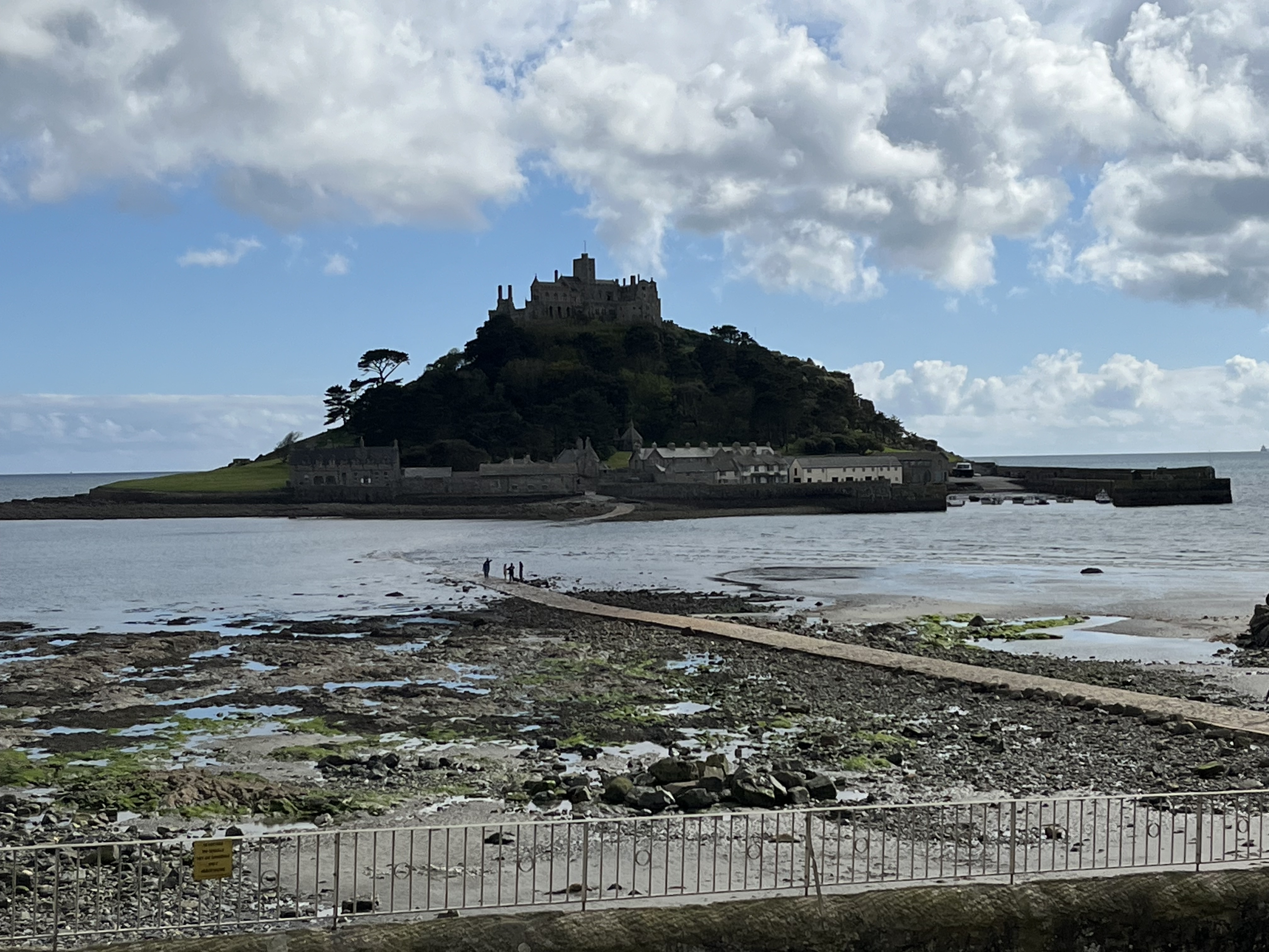
Porthleven has a really pretty harbour and I spent thirty minutes looking around, there’s also plenty of seats for taking a short break. The next few miles are along gently sloping grass covered coastline and the distance went by quickly as I listened to the Lord of the Rings audiobook on my phone. At Rinsey East Cliffs the ground turned from short grass to tall gorse bushes and I had to take extra care with my navigation. I then descended the cliffs and having removed my shoes/socks I walked along the waters edge of Praa Sands. Back on the cliff top I saw a small group of people aimlessly wandering around. I approached them and they enquired with me how to get down to another small beach at Kennetty Sand. I could see the beach but didn’t have any idea how they could get down the cliffs. I hope they got there safely. I walked around Cudden Point and got a far away distant view of the impressive St Michael’s Mount and its respective castle. At Perran Sands I had my final refreshment break on a bench close to the public toilets before I turned my attention towards Penzance. Although I could see that the tide was going out I had decided not to walk to St Michaels Mount. I’d visited there in 2017 during my Lands End to John O’ Groats adventure and didn’t feel like I was missing out.
The last three miles was along the concrete promenade between Marazion and Penzance. By the time I had reached the edge of Penzance my feet were aching and I was pleased to finally arrive. Unfortunately the youth hostel in Penzance is almost a mile from the coast and the last mile of the day is always the longest and the toughest. I arrived at the hostel and pitched my tent just as the sun began to descend. There’s a large group of school kids staying in the hostel and I spent my evening watching them run around the building and wishing that I had their levels of energy.

Well done James,keep it up! 👍
LikeLike