Day 154: WESTON-SUPER-MARE to PORTISHEAD
Wednesday 12th March 2025
Today miles: 21.3 Total miles: 2525.6
Today had the potential to be hugely problematic. Let me explain, throughout my time walking the ECP I’ve followed several blogs from people who have successfully trodden the same path. Each one had explained in detail the difficulties that today’s walk carried. Each had individually tackled the routes main issue, crossing the River Yeo, in their own frustrating but admirable way. Last night following the advice of one of these previous trailblazers Charles, I tried to contact the owners of Icelton Farm and was willing to beg for permission to cross Tutshill Sluice, by far the easiest way to cross the River Yeo. There’s no answer, so I left a quick message asking for the aforementioned permission and kept my fingers crossed overnight. Later that night, whilst trying to work out a much longer Plan ‘B’ (just in case) I found out that the sluice at Tutshill has fairly recently become a permanent section of the Pier to Pier Way cycle route. The cycle path was formally opened only a couple of years ago and it now runs between the two Grand Piers of Weston-Super -Mare and Clevedon, brilliant news. I left Weston around 8am and skirted around the now green algae covered Marine Pond. After passing the old and disused Birnbeck Pier I took to walking along a dirt track alongside the minor road adjacent to Worlebury Woods. The English coastal path then rounds Sand Bay and then inexplicably ends at Kewstoke. Beyond Kewstoke the route which has yet to be developed as a section of the ECP continues up to Woodspring Priory. There’s some great views out across the mouth of the Severn Estuary towards Cardiff on the opposite bank.


The next few miles along minor roads was straightforward and traffic was light. As I approached Wick St Lawrence my mobile rang, it was the farmer from Icelton Farm returning my call. Within a few seconds of speaking to Farmer Martin, to my utter surprise he asked me “Are you carrying a grey and blue backpack” I was confused (but only for a few seconds) but then looked to my left and spotted Martin leaning against a nearby gate. We spent a while chatting. He’s a really nice man and he confirmed that the route across River Yeo was accessible to everybody. I was pleasantly surprised when a few minutes after waving goodbye to Martin I chanced across ‘The Owl in the Oak Cafe’ I sat down with a coffee for a while and watched a steady stream of cyclists leisurely riding by. For the first time on this trip it began to rain, it wasn’t heavy, so I didn’t need to bother with any waterproofs.

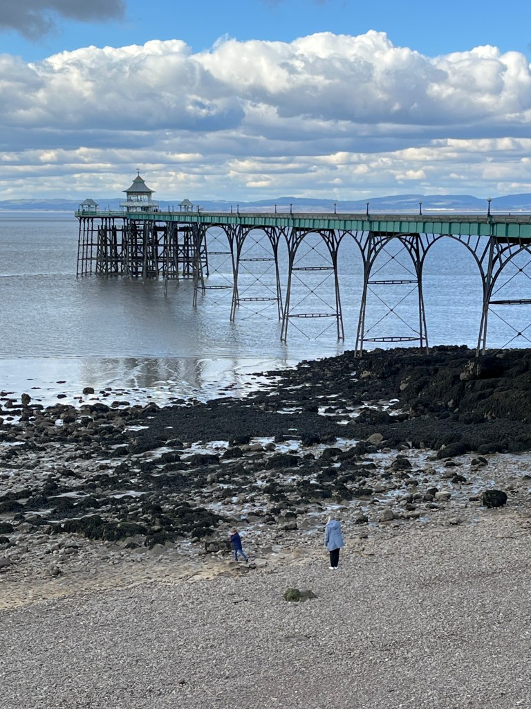
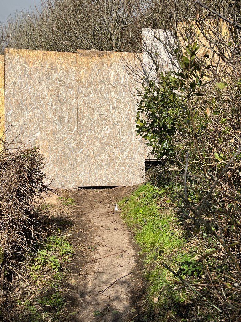
There’s a series of minor roads for the next three miles until I reached Dowlais Farm and arrived back on the coast. I passed half a dozen farm tracks which would have got me back onto the sea wall quicker but none of these are marked as public footpaths on the map so I gave them all a miss. Arriving back on the coast there’s a strange paved track for the final mile towards Gullhouse Point. After another short break I walked around Wains Hill and entered the outskirts of Clevedon. There’s another bathing Pool (Marine Lake) at Salthouse Bay in Clevedon but this one’s much cleaner and appears to still be in use. The promenade skirting the coast of Clevedon is pleasant and I arrived at the end of the ‘Pier to Pier Way’ at Clevedon Pier still feeling reasonably fresh. Things then got a bit weird. I carried on through Clevedon and the path switches between a minor road/track running alongside some large posh looking houses on the hillside. I then walked past half a dozen similar sized houses on my right which were unexpectedly fenced off, boarded up and covered in ‘Do not enter’ signs. A hundred metres further along there’s a chipboard fence across the coast path, blocking any further progress. There hadn’t been any ‘route ahead closed’ signs for me to ignore and I begrudgingly trudged back the way I came, studying the map as I walked, trying to find a suitable alternative.

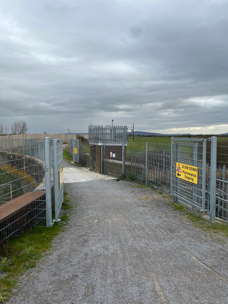
I headed slightly inland towards the B3124 and then after a half mile turned left once again towards the coast and hoped the route would once again be accessible. I spoke briefly to the greens keeper at Clevedon golf club, they were aware of the coast path but they weren’t sure why the route was blocked off. Anyway, I managed to get back onto the coastal path and continued along the hillside for a further three miles through Portishead. I arrived at Portishead Marina at the Northern end of the town around 4pm. As I crossed the Northern lock, which is officially the coast path I noticed it was closed for repairs. I’ll be using the Southern Marina lock tomorrow but for today I’m heading into Bristol and the first of three nights at a backpackers hostel. Here’s hoping there’s no drama.
