D145: INSTOW to CROYDE
Friday 20th September 2024
Today miles: 16.6 Total miles: 2379.2
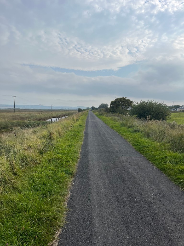
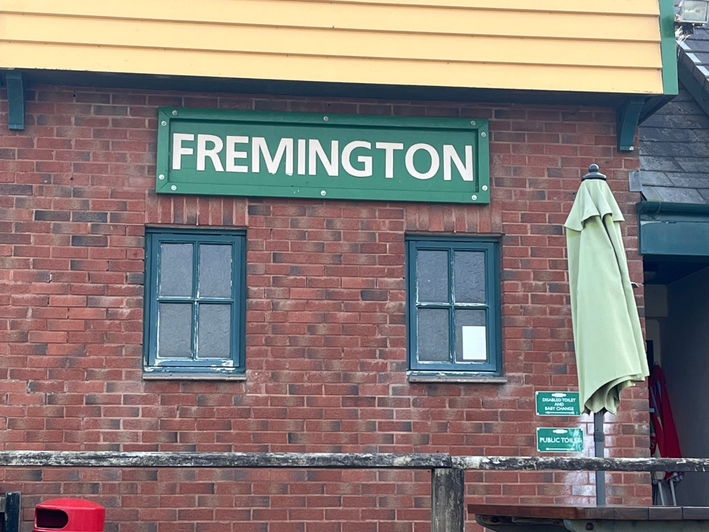
After a fairly late start I left Instow and immediately continued to walk North along the Tarka Trail. A few minutes later the route left the Tarka Trail and skirted around the edge of Instow Barton Marsh before rejoining the trail once more two miles further North. Unlike the last few weeks, the vast majority of today’s walking is remarkably straight and pleasantly flat, along a great track. There were lots of cyclists and an occasional dog walker. The view over the River Taw would have been good but there’s a low lying, eerie mist sitting over the water. An hour later I was skirting around the Northern edge of Fremington town. There’s a bridge over Fremington Pill and just beyond there’s a nice cafe. I dropped in and ordered myself a coffee, a can of fizzy drink and then spread out my wet tent on a nearby wooden bench. An hour later I left the cafe feeling fully refreshed, with a completely dry tent. The excellent path continued towards Barnstable. I’m surprised by a lack of seats along this track, the views across the river are pretty enough but there’s nowhere to rest. I was able to cross Taw Bridge and save myself a few hundred metres of walking by climbing up the steep embankment and then hopping over the metal barrier. The next half mile was along the Northern shore of the River Taw. There’s an industrial estate on my left but the grey ugliness is well hidden behind the thick hedgerow and a line of trees.

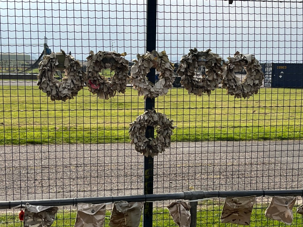
I then past by Royal Marine Commando base Chivenor. This is a former RAF base near Braunton. Unusually for a military base there’s lots of people in various uniforms and dozens of military vehicles busily moving around the site. At the Southern end of Braunton, believed to be the biggest village in England, the route crosses the River Caen and then skirts the edge of the river to Horsey Island. The Horsey Island perimeter footpath is still closed to any public access due to an eroded/collapsed section of the sea wall, thankfully there’s an easy alternative path to get to the start of the dunes. The next three miles was me just picking my way through the dunes, which are by some distance the highest that I’ve seen on my coast walk. They were huge. Thankfully the route didn’t involve me having to climb any of these monsters. On arrival at Staunton I took another much deserved break and looked back towards the route I had just walked. It’s an impressive viewpoint, especially with the tide now being out. After checking the map I decided to leave the SWCP and instead just trudged along the B road, which is closer to the coast. In hindsight it wasn’t the right choice, the road was narrow, busier than I had expected and not a pleasant experience.


I arrived at Chesil Cliff and left the road unscathed . The route for my final mile is a nice, easy walk across the sandy beach at Croyde Bay. I eventually located the huge holiday park and got booked into the site. It’s busy and I suspect I’ll be having a restless night. I got myself something to eat from the chip shop and then sat in my waterproofs watching the rest of my clothes go through the washer and then drying at the launderette. I managed to scrounge a load of washing powder from a lady at the launderette, thank you Joan. Back at the tent it’s more Netflix and an entire family bag of peanut M and M’s.
